Task #6569
closedFeature #6514: Retrieve facets of the geohashes for all search results and map those facets
Map markers for most results when the number found is less than a certain threshold
0%
Description
Once the result list is less than 75 or so it becomes easy to just display a marker for every result instead of tiles. Especially for smaller metacat repositories which may not have an interesting looking tiled map.
Files
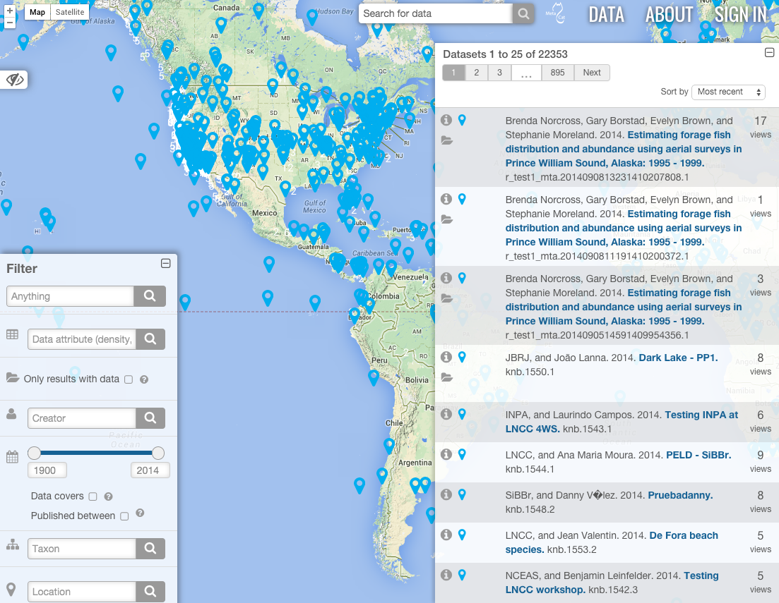
| Screen Shot 2014-09-18 at 7.56.50 AM.png (658 KB) Screen Shot 2014-09-18 at 7.56.50 AM.png | How the map looks with a higher precision geohash coupled with a low zoom level. |
Updated by ben leinfelder over 10 years ago
Couple thoughts:
- the threshold should match the page size (KNB is set to 200)
- marker clustering library should still be used so that close study sites or packages from the same site don't read as a single point.
We also talked about always mapping the tiles and the markers for the current page, but only showing the point markers when you hover over their entry in the result list - is that still a feasible approach to maintaining the cool pan-to-point-and-show-abstract feature?
Updated by Lauren Walker over 10 years ago
- Subject changed from Map markers for every result when the number found is less than a certain threshold to Map markers for most results when the number found is less than a certain threshold
ben leinfelder wrote:
Couple thoughts:
- the threshold should match the page size (KNB is set to 200)
I may reduce the page size since 200 was chosen to get hte map populated as much as possible. I think 200 datasets is enough to look better with tiling rather than 200 markers. And is probably faster.
- marker clustering library should still be used so that close study sites or packages from the same site don't read as a single point.
I agree that clustering datasets at the same point or around the same point should always be used. I will probably stick with the tiling vs marker clusterer library so that the interface doesn't switch from rectangles->circles all of a sudden.
We also talked about always mapping the tiles and the markers for the current page, but only showing the point markers when you hover over their entry in the result list - is that still a feasible approach to maintaining the cool pan-to-point-and-show-abstract feature?
Yes, I think showing the marker when you hover over the dataset in the list is still a good idea. I will add a ticket for this specific feature. It should easily be done since when you are hovering over a dataset in the list, those DOM elements have all the details necessary to create the markers and infowindow (title,id, bounding box, etc).
Updated by Lauren Walker over 10 years ago
I am mainly trying to avoid having a map for a Metacat repository with only ~40 datasets in the same area with one big "40" tile. Kinda boring. So maybe this should be implemented as a easily-configurable way for different themes to specify a minimum count for drawing tiles. So a theme may have tiles turned off completely.
Updated by Lauren Walker over 10 years ago
- File Screen Shot 2014-09-18 at 7.56.50 AM.png Screen Shot 2014-09-18 at 7.56.50 AM.png added
- Status changed from New to Resolved
- translation missing: en.field_remaining_hours set to 0.0
For now, the map will draw a marker when there is only 1 result for that geohash tile.
The Map Model can be changed so that the zoom->geohash_level association allows for a higher geohash level on lower zoom levels. For example, the Map Model defualt is that at the minimum zoom (with whole world visible) the geohash level is 2. A MetacatUI setup can change this geohash level to say, 5, resulting in a map with many markers. (See attached screenshot). Of course, this looks terrible, so users who set up Metacat/MetacatUI should play around with their map settings to see what is best for their particular data catalog.
EVOS Gulf Watch for example, would probably want the initial map center to be somewhere in the Gulf of Alaska area with an initial zoom level appropriate for that area.
The "marker clusterer" for the new goehash map are the tiles. So setting an appropriate zoom->geohash association will clear up that ugly map with markers standing on top of each other.
And of course users can turn off markers altogether so that only tiles are drawn.